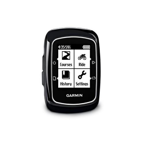
Most: * It is easy to transfer the Edge 200 to a computer a course on the site of "garmin connect" then save the file corresponding .gpx to obtain the route 25/1000 on IGN maps on the site "Visugpx ". * Just as easy to prepare a course on site maps to "garmin connect" and transfer it to the edge 200. After on-site guides you well to follow your path. * Acquisition of fast satellites. He is not bothered even in forest. Cons: * It takes an internet connection. * It is linked to the site "garmin connect". * The instantaneous speeds are false. * It underestimates the distances of about 10%


![Battery DURACELL D364 - 364 - SR621SW - SR60 - RW320 [Electronics] (Electronics)](https://img.tgreer.com/thumb/85x85/7/10/71000e52fad26de6.jpg)


