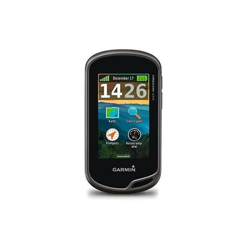
Garmin Oregon 600. Reference: 010-01066-00Garmin Oregon 650 including 8MP KameraGarmin Oregon 600 SKU: 010-01066-00
Garmin Oregon 600T SKU: 010-01066-11Garmin Montana 650T GPS
Caveat: I'm trying to keep this review always up-to-date and adapt them to the current firmware. In the first line I always write on the version, the review
applies.
Preliminary remarks:
I currently own - also used professionally - GPSMAP 60, Garmin Colorado, GPSMAP 62s and the Oregon 650. The units are (except for the Colorado) partially daily use, the track record on all devices ever and on a time interval of 1 / 2/5 / 10 second set, depending on the application. All tracks are read and stored in a database for later
Evaluations to drive. All devices each have latest firmware. I speak Part of the message to the "accuracy indicator" of devices. A good explanation
to the accuracy indication can be found here: [...]. An FYI: The "Test laps" described below show all devices "Genaugkeiten"
well below at 10m. I mention this only for completeness ....
---------------------------------------------
Hardware:
I would hardly go into the hardware - because in my opinion, the unit has to date the highest quality, the Garmin ever produced (in Outdoor GPS segment).
Gap dimensions are perfect, everything is there where it is, the device is "rough", fits well in the hand, is "small enough", the display is really good, the power consumption "ok"
Mounting options very good, overall "valent" and robust.
Negatives:
- Battery consumption slightly "worse" than other devices (with the same Displayheligkeit) Deduction: 0.1 point
- Rubber covers something "niftlig" deduction 0.1 point
---------------------------------------------
UI software:
The only mistake the MIR currently noticed:
- German translation error
- Cache-Display the German language setting
- Every now and then crashes
- Position "freezes"
--------------------------------------------
Up here the device from me 4.5 of 5 stars would have received.
GPS receiver and track records
And here the device begins to slip up. I've been using the device now the 13th time our "test track" graduated from me now present 72 tracks (dogs round).
This leads over fields, through coniferous forest, mixed forest, leaf forest and a small ravine - my opinion, so a versatile "test track".
Due to the 72 present "reference tracks"; mostly with the '60s and' 62s created, and an official map of the Survey Office can be the tracks of devices
evaluate good. The 13 laps with the Oregon 6XX were completed in good weather, bad weather, fog, rain and "gray weather" on 13 different days.
This reflects major problems:
a) Drifting. Although obediently goes straight drifts of track up to 130 meters from the actual distance from and that even on dirt roads with no obstructed view of the sky.
In perfect weather, this behavior is rather less, "from" gray weather ;-) to "rain" the behavior is getting worse. The GPSmap 60 shows this
Behavior does not, the '62 since the last firmware versions significantly less.
b) deviations of up to 150m from the actual position - then sudden "jump back" on the road
c) permantente allow deviations "in a direction" that dissolve only after rebooting. Means: The track record is consistently "shifted" eg 90m eastwards.
d) In bad reception (display still 5 bar / 13 satellite GPS + GLONASS) wanders the unit "off", völligst uncontrollably in different directions and the up to 166 meters.
e) The machine detects hardly remains when you "stand" - the trip computer shows no "pause" in but believes it continues to move. Leaving as the GPS60 and the Oregon 6 side by side in the meadow with a clear view of the sky are, shall submit to the GPSmap 60 in an hour about 40m distance to the Oregon 600 brought it to an hour to 4.56 KM !!! ! although
both devices resting on the meadow lay (no shading). The 60 shows 58 min "pause" on / 2 minutes movement against the Oregon 35min "Pause" and 25min in motion.
f) GPS versus GPS + GLONASS:
It's kind of weird, and really I can not explain it. But the tracks that seem to be so far recorded with "only" GPS on average more closely to reality
to lie than with GPS + GLONASS. An absolutely daring conjecture with 0% guarantee is: The receiver seems overwhelmed with the calculation of "too much Satellite" to be and
interpolates the values even more than he (pointless) does it anyway.
Now comes the final assessment:
Calculates the result looks like this:
At a distance of 6.5km (per round) are included with the
GPSMAP60 85% of the recorded "points" in 10 radius around the actual point of measurement second by second basis.
GPSmap62 73% of the recorded "points" in 10 radius around the actual point of measurement second by second basis.
Oregon 6XX 56% of the recorded "points" in 10 radius around the actual point of measurement second by second basis.
Side note to the "Statistics": basis are 72 tracks with GPSMAP60 and GPSmap 62, + 13 tracks with the Oregon 650 and underlying reference vectors of the Survey Office.
It was compared: deviation of Oregon track to the "official map", Oregon deviation to the mean value of the 72 tracks. Deviation of Oregon track to the total number 72 Tracks + official reference points. Each track contains Roundabout 4200 points.
I realize that this is not a highly scientific assessment, but at least the impression is something subjetive underpinned with "numbers".
How to assess a car which is indeed perfectly finished, top "looks", but good quality is built stops every few feet, moves to the right while turning to the left
etc. Clear that the comparison limps a little, but I personally would give this vehicle only 1nen star. As the "reliable driving" the car the a / o remains that should "relatively" reliable
Positioning when GPS is the most important point to stay (personal opinion).
Stated somewhat Salop: The Oregon 6XX "packed" bad position calculations and broken interpolated values in a beautiful, stable and practical garment.
For whom the Oregon 6XX is therefore "good" suitable:
a) persons to whom the exact * positioning does not matter
b) cyclist the most "clear view of the sky" have here are the results a bit better
c) Hikers will see the only occasionally on the map to get your bearings
d) users belonging to the group AC and looking a really solid and robust device
For whom the Oregon NOT suitable:
a) OSM mappers / private surveys
b) hikers and mountaineers who rely to an exact positioning *
c) technology enthusiasts get the NEN hiccups when the location indication alone again "hike" goes
d) to search Maybe geocachers who like to rely on your GPS and then not "next" 100 meters ...
* With "exactly" I mean personally: The values differ on average a maximum of 30 meters of the actual position
Conclusion: It bleeds me a little heart in the evaluation - because the device is the hardware side, really great, but totally messes up in the really important discipline: a (relatively) accurate
Positioning.
More Links:
Garmin Forum: [...]
Naviboard: [...]
Naviboard: [...]
I see external links from Amazon will be automatically removed. Too Bad.
**** Update 07/22/2013
Since the results are better on the bike in perfect weather and no visual obstruction to the satellites, my rating has been raised to 2 stars.
**** Update 06/09/2013
Gradation of 1 star because a) has not changed the above defects and b) In addition, the unit after 2 weeks "knatscht & crunches" if you take it in hand and want to press buttons.
The behavior with the bouncy and crunch had the '62 already. Apparently Garmin has not learned here. Too Bad. Therefore: Now again only 1 star.