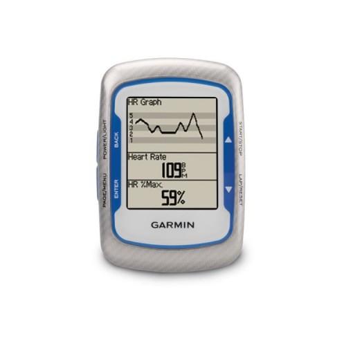
I use the GPS for almost a year and I am particularly pleased. It has a very good battery life (15-17 hours) and is rechargeable via USB. I appreciate the opportunity to set different screens with many integrated functions. For example, in the mountains, I use a screen that gives me the altitude, percent slope, cadence, speed, heart rate ... It is thus possible to control everything. I will not revisit all the features that make this GPS counter very useful for a cyclist. Its advantage is to be small but in return, he sometimes lost the satellite signal under trees and overcast sky. For added reliability, prefer the Garmin Dakota, bigger and more sensitive but also well suited to cycling. The use of the Edge 500 Owner is very concise and it is through experience that manages to make the most of this unit. I found on the internet a function not to implement with Garmin software: to develop a road book which will be returned during the hike. The site "Ride with GPS" can transform the virtual partner in the GPS route descriptor with signs and indications written direction, timing and accurate mileage. This site is in English but not in French unfortunately. It is still easy to use and very complete with a paid version. The Virtual Partner is a feature that tracks a stored record by making the same average as in the previous release. It displays the route to follow on the screen but nothing that the course is nothing to do with an automobile GPS like Dakota. "Ride with GPS" amplifies this possibility to program the track in advance on his computer and pointing to follow all instructions on the GPS screen at the bike trip. I find this very practical function.