So far, we drove 4 tours: 1 even planned test tour (50 km), 1 downloaded Bikemap-Tour (65 km), a ADFC Tour (65 km) and a portion of a bike line-round trip (169 km): The navigation performance of Teasi was absolutely flawlessly in all these trips, even and especially on dirt roads and in the woods (a dropout I have not had in the meantime a total of about 20 km of forest ride).
Our wheels: Cross with Smart Sam tires - our tours: mostly round trips between 50 and 400 km, 70% road and 30% field / forest paths.
Unrestricted buy recommendation for Teasi one2 for this kind of use !!
November 2014, by now a total of 2,600 EXPERIENCE Teasi-KM:
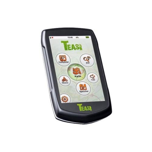
First of all: The Teasi continues to be exclusively used for navigation by day or multi-day tours and still works perfectly and absolutely reliable !!
... However, the light and shade the maps available on the Internet:
1. The advertised platform "Bikemap" provides in spite of such advertising at virtually no usable finished routes: individuals make any "crap" (eg tens of Test tours of 1-2 km) pure, more trips (> 20 km) run almost exclusively on or along roads (mostly well received by bike), beautiful tours etc. including well-passable dirt roads result, I have not found.
The amount of the so-called. "Official routes" (of information offices, etc.) is more than manageable.
Conclusion Bikemap: to use ready to Download routes barely, to plan and save your own routes but full well (see 5, below.)!
2. Downloadable GPX routes from homepages of information offices od. Tourism associations are mostly "junk" because they were probably planned by non-cyclists, PC GPX newcomers or other "experts", some are the routes offered by the Teasi not processable.
3. ADFC Routes: If you buy a ADFC card, you get a code supplied to download the map route shown in GPX format can. However, these voices often are not in accordance with the marked routes in the map ...
4. Bike Line: When purchasing tickets you will find your code, the downloadable tours are reliable and top (according to maps), but it is tied to the stages proposed there.
5. Self-planning: This works best by far !! Cycling map Buy (Bikeline or ADFC or ...) and transfer the route to be traveled (s) in Bikemap manually - with a little practice you need good for about 60 km one hour. Benefits: Flawless navigation of Teasi, the saved route is consistent with the Card Account, you can plan trip, and multi-day trips you can plan the length of the stages as you preferably.
Approximately But 80 km per stage / tour the border both in Bikemap and Taesi.
Conclusion after approximately 2600 km:
1. A few good, useful finished cycling maps on the Internet.
2. Recommendation: Self-planning with Bikemap based on conventional paper-biking maps!
Enjoy the Teasi !!