First, the negatives:
Criticism of the workmanship is very well justified. I have the clock for 2.5 years. Since the Lunette broke 2x, without any use of force was responsible for it. After all, this was always under warranty. Now, however, the plastic strap is broken in the middle of a tour. Today I am sending the unit for repair, unfortunately, at my expense. ***)
Well, however, is that the clock is built principally robust (actually a contradiction to the above written), so I can safely carry in any weather on mountain tours. Also, I can take them safely to the beach and into the water.
Functions / Software:
This clock is a highly complex device because of its extensive features and capabilities. Who thinks he can just buy the X10 and then use it without intensive training, which does not irritate their abilities. Training is a must !!!
Weaknesses I find hardly.
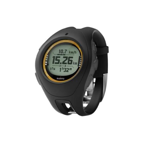
Only the GPS reception could be a little more sensitive. But if - as I always practiced the - the clock a little time before the tour leaves to get the GPS fix (it therefore can lie on the car roof for example a few minutes, while backpack, boots and poles are being prepared), the may start from a reliable GPS reception. Incidentally, I use the GPS update rhythm to 1 minute. This makes the battery life significantly increased (> 1 day).
Just before the tour I oak Whatever the altimeter, which then subsequently reliably indicates to me the current altitude. I find it very convenient to check the position with a view to the wrist. The run-rhythm is not interrupted.
Very good I think the addition of the GPS receiver by the electronic compass. If a destination has been targeted and in the meantime breaks off the GPS fix, the compass takes the route guidance (quite reliable, as long as you no major side "trips" organized).
The device comes into its own but only fully from when the tours at home on the computer (eg with TTQV) prepared and routes (each on max. 50 points is reduced) and Waypoints transferred to the device.
Here I have, however, a strong criticism of Suunto to bring: It is claimed that it is possible, etc. transferred to the X10 routes and waypoints on foreign programs like Magic Maps. But this is only partially correct. Since the Suunto X9 has the necessary drivers to not revised. Neither with MagicMaps even with programs like TTQV you can achieve direct communication with the X10. Also CompeGPS / country can only rudimentary. The included Suunto program "Suunto Trek Manager" handles the communication, but is autistic. Exchange formats such as GPX does not know Suunto. If there were no GPSBabel, then you would be largely cut off from the rest of the GPS world. There was reason (not only by me) abundant inquiries and criticism at Suunto. But this seems to bounce off without a trace where. I interpret this as pure arrogance.
But still: GPSBabel is to solve the communication problems.
Despite all the criticism, the X10 (I have the Military version) a highly useful and valuable device for actions such as hiking. To my knowledge, there is no alternative on the market.
***)
Addendum: The Service of Suunto I give 5 stars. Though 2.5 years, the warranty period was considerably exceeded, replacing the defective me Suunto wristband for free. Both repairs were carried out before (within the warranty period) were made incl. Transport Germany Helsinki within 3 days.