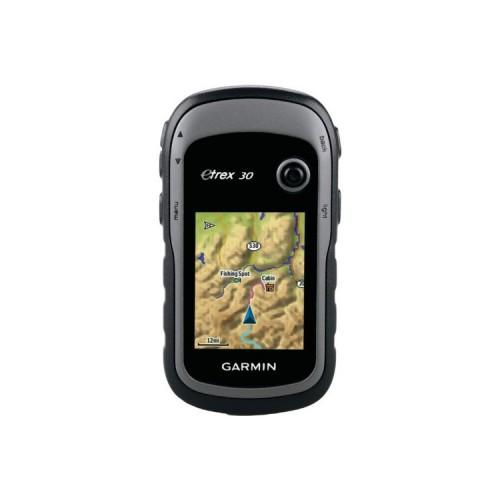
I and I have a GPS road package and hiking all brands. My passion is geocaching for 5 years. My favorite GPS has long been the 60CSx and in my opinion it is the best choice for hiking and above all provides a more intuitive use. For geocaching, the features of the eTrex 30 make it unavoidable.
This commentary was revised several times based on software developments. Today I use it almost daily for 6 months.
From a hardware point of view it's OK with a 3D compass of good quality and easy calibration (30 seconds to 3 easy steps each battery change). The reception GLONASS + GPS makes accurate device in all circumstances. Positioning is often fixed with over 20 GPS satelites used unlike legacy. The accuracy of 3m is not misused.
The display is highly readable but sometimes I have a little trouble to "click" with the mini joystick on the top right.
The battery life is excellent with Eneloop he holds without problems a day of intensive use.
Note however the screen that is sensitive to scratches (protection to predict). In addition, the GPS solution is provided without fastening the belt. Garmin sells a kit to predict. Also plan an SD card for additional data even if the GPS base memory is already high.
Since version 3.20 (August 2013), the software is finally stable. I just reproach few problems of ergonomics. It manages without problems several maps (the base is frankly limited), several thousands of caches or points of interest to see orthophotos. However, careful not to overload the GPS if performance degrades dramatically. From 2500 caches and many pictures above, the use becomes laborious (slow).
For TOPO maps, OpenStreetMap community offers good quality free cards, legally and freely available on the Internet (search "free and Free maps of France for Garmin GPS" and you will find!).