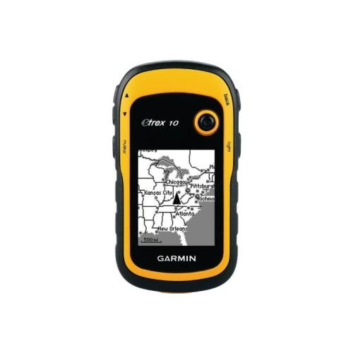
Handiness and operation:
The device is so small and light that you can have it always with you. My older device with external stub antenna fitted not reasonable in the pocket, therefore I had never doing what it has actually rendered useless. The operation is not as nice as in a larger device: the display is relatively small and there are hardly any function buttons on the device.
Grid and coordinate systems:
It offers a variety of bars and coordinate systems like UTM / WGS84. The complete list is too long to enumerate.
Accuracy and reception:
Like any GPS Handempfaenger, ever built, the accuracy of this device is far higher than that of a topographical map. Consider if a forest road at 1: 50k is drawn with a Strichstaerke of 0.5mm in the map, then this corresponds to a real already width of the path of 25m. The device can use both GPS and GLONASS satellite. The unit is also in the forest quickly a princely number of satellites.
Views and features:
The unit can display distance and direction to a waypoint as numerical values, making it suitable for combination with a compass. What is missing is a battery indicator in any view. For the battery indicator you have to sacrifice an info box. The eTrex 10 can display sunrise and sunset. There are a variety of other features that are not clear to me, but can be easily ignore.
Electric stuff:
If you use the device reasonable, it turns on only when needed and a direction then takes on the compass, then holding a set Eneloops weeks. The device reports as USB Storage on the PC. The data transmission also works on Linux.
Conclusion:
Very good suitable device for walking, I would buy it again. Reception and speed are in the forest super, no more than the old 12 channel receivers.