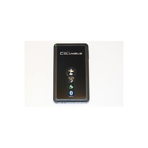
The GPS Logger V-900 is a very handy and simple GPS receiver with a simple three-button operation. With a continuous operating time of about 20 hours, he is even longer transports without charger. The GPS antenna receives very well and finds the current position usually within 40 seconds after switching on.
The reception also works when there is no direct view of the sky. While hiking and cycling, it is enough to grab the receiver into the backpack, put the car on the center console, even in some aircraft I could record the entire route.
Features / characteristics:
--------------------
*** GPS Logger
(Characterized by switching seconds each, the current position on)
*** GPS Bluetooth receiver
(Works over Bluetooth with laptop etc)
*** POI (Point of Interest) recording
(A button is marked so that it is highlighted later on a map, for example, the holiday assign the current location.)
*** VOX voice recording
(Lateral VOX key is pressed and held, a voice memo can be recorded as a .wav file.)
*** Spy Mode
(At adjustable intervals, the device uptime restarts automatically, saves the current position and returns to standby. Then up to 30 days on a single charge!)
*** Turn on / off automatically Power
(Connected to the car's cigarette lighter, the device switches itself on and off when the ignition is switched on or off.)
*** Speed Alarm
(Warning at previously set speed warning threshold.)
*** CMS software Time Album, data can be conveniently used as routes for Google Earth export (.kmz or .nmea files).
*** Included software generates a summary report, the journey time, average speed, distance, and breaks Special maneuvers such extreme acceleration and heavy braking contains.
*** As an interface to PC and for charging is a mini USB port.
Recorded information:
-----------------------------
Every second will be recorded with the current position number, date & time, coordinates, altitude, speed, direction, 2D / 3D information and other information. These are stored in a text file with extension .csv, which can be evaluated later easily in Excel and other programs. The storage medium is a low-cost MicroSD card is used, sufficient continuous operation for many months.
The existing columns are denominated in expert mode:
INDEX, DAY, DATE, TIME, latitude, longitude, height, speed, HEADING, FIX MODE, VALID, PDOP, HDOP, VDOP, VOX.
Configuration:
--------------
Some settings, such as alarm threshold for speed or time interval for spy mode can be performed via the included software Time album. The settings are stored in a CONFIG.TXT file that is stored on the memory card of the GPS logger. If the file that is not a problem, then the GPS Logger works with default settings.
The CONFIG.TXT file contains eg the following five lines:
1,000,002,
notes:
1 Professional fashion
000 Over-speed tag
002 Spy mode timer
The meaning is almost self-explanatory. The expert mode is switched on, so all GPS information is stored. Speed alarm is not activated. In espionage mode of GPS Logger goes after every positioning for 2 minutes in standby and then automatically switches back on.
Switching between normal recording mode and spy mode is actually quite simple. Only the On / Off button for one second, the unit turns in the normal mode and the power LED is green. If / simultaneously pressed laterally when you press the on off button, the voice recording button on the unit, the unit is started in Spy mode, and the LED lights up blue. Changes the LED during operation to red, the battery is low, and the Logger is still about half an hour and then turned with a long beep.
Conclusion:
------
Mir makes the device a lot of fun, and I have always new ideas. For example, can be in the Excel altitude calculate and graph, or climb and descent in the Alps with associated curve radii and speeds. Or what-is-the-best-way-to-work scenarios, better go in a traffic jam on the highway or prefer highway?
Tip:
-----
A small tip at the end of this report, I recommend the English version of the instruction manual, it is a bit more detailed than the German version. In addition, the freeware NMEA2KMZ has proven, at which the log files can be converted into various formats (KML, KMZ, GPX, NMEA, CSV). This also allows detailed choose which information (date, time, speed, POIs etc.) in Google Earth files (extension .kmz) should be included and which not.