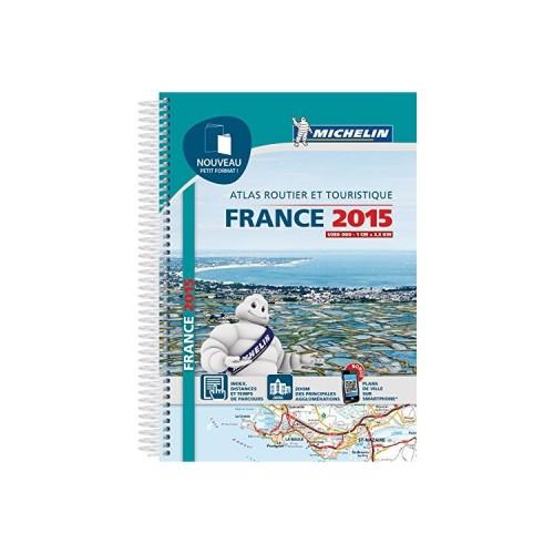
- This half-size not only makes it easier to peruse (stationary, puisquau wheel is not recommended for security), but also easier to store in the vehicle as it comes more easily in a glove box , a door-empty pocket, etc.
- Reading is convenient thanks to the large plastic spiral.
- The city maps are also simplified, and these are downloadable (via a "QR code" printed) on your smartphone: zoom, find, roll!
- By cons, CAUTION, this atlas is certainly very light, but perhaps a little fragile as a whole and, if one is not careful, the paper tears easily.
- Compared to the large version, there are also loses little stickers index (bearing the image of the Michelin man) who were very practical and supplied including 2014 versions; they allow to identify / report one by one the cards in your personal journey and find them more quickly
In summary, little change, except for the format and some details, you can plan your trip with the CARD MAJOR AXES road, full of INDEX COMMUNITIES, TABLE DISTANCES and of COURSE TIME. The SITUATION CARTERINE allows you to easily locate you in the atlas on each spread. QR CODES, next to each PLAN CITY, you will drive on the last kilometers with your smartphone.
Here, I would still tempted to recommend the plasticized version a little more expensive, certainly, but stronger if you do not renew your atlas every year or you want to scribble on it and then delete! However, this version is the cheapest: less than 12 euros / year, as well, knowing that an update GPS can cost up to 30 euros, it's a good product in terms of value. In addition, on your smartphone, you have free access to the site Michelin.fr to complete your information when your stops at rest areas.
Good trip