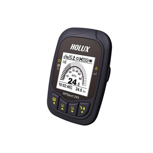
I want to confirm that the unit for a long time, very persistent and very accurate data recording. Even after 2 weeks Jakobsweg 90% memory was still free. I've done all published firmware updates. Jadesmal change a few unimportant functions. The blunders are not eliminated. The display of the distance km deviates by about 5% to 10% from the correct route. But only in the display. If you read the data, so the lower, right route appears already in the ezTour software. Example: Display on the instrument 12.3 km - distance read - display at ezTour 11.7 kilometers. I've checked with other methods often. The lower path is the right one. The average speed, which is displayed on the device, expects an even breaks. The result is an unusable value. Another reviewer before me has this misrepresented my opinion. An addition of altitude, as would be desirable, the device is however not possible since there is no barometric altimeter. The heights determined by GPS are in principle not suitable, as much too imprecise. It would end only to come out of mischief. The biggest shortcoming of the software ezTour is that the distances practically not leave edit. Here I use the MagigMaps software, which is expensive.